The GeObservatory service of the Operational Unit BEYOND Center of Earth Observation Research and Satellite Remote Sensing of the National Observatory of Athens, was activated to map ground deformation induced by the Western Turkey earthquake, M6 of October 27, 2025, 19:48:28 UTC.
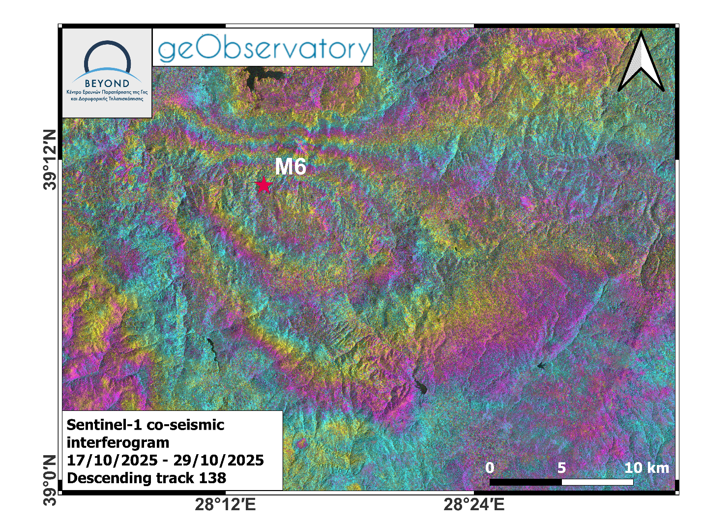
Co-seismic interferogram was produced with the use of two Sentinel-1 images of October 17, 2025 and October 29, 2025 of descending satellite track 138. In the co-seismic interferogram, surface deformation induced by the seismic event is mapped. Each fringe corresponds to a ground deformation equal to 2.8 cm. All co-seismic and pre-seismic interferograms, associated with the event are freely available in the geObsevatory website (http://geobservatory.beyond-eocenter.eu/).
-//-
Δορυφορική συμβολομετρική απεικόνιση του πεδίου εδαφικής παραμόρφωσης από τον σεισμό στην Τουρκία (27-10-2025, 19:48:28 UTC).
Η υπηρεσία geObservatory του Κέντρου Παρατήρησης της Γης και Δορυφορικής Τηλεπισκόπησης BEYOND του Εθνικού Αστεροσκοπείου Αθηνών, ενεργοποιήθηκε και κατέγραψε την εδαφική παραμόρφωση, που προκλήθηκε από τον σεισμό στην Τουρκία, Μ6, στις 27 Οκτωβρίου 2025, στις 19:48:28 UTC. Δημιουργήθηκε συμβολογράφημα με χρήση δύο δορυφορικών εικόνων Sentinel-1 από τις 17 Οκτωβρίου και 29 Οκτωβρίου 2025. Στο συμβολογράφημα είναι εμφανείς οι μετατοπίσεις του εδάφους που προκλήθηκαν από τον σεισμό. Κάθε κροσσός συμβολής αντιστοιχεί σε εδαφική παραμόρφωση ίση με 2.8 εκ. Όλα τα διαφορικά συμβολογράμματα που σχετίζονται με τον σεισμό, είναι διαθέσιμα στην ιστοσελίδα του geΟbsevatory (http://geobservatory.beyond-eocenter.eu/).
Figure 1: Co-seismic interferogram of descending track 138 of Western Turkey earthquake (Μ6, 27-10-2025, 19:48:28 UTC).
Εικόνα 1: Συμβολογράφημα καθοδικής τροχιάς δορυφόρου, για τον σεισμό στην Τουρκία (Μ6, 27-10-2025, 19:48:28 UTC).