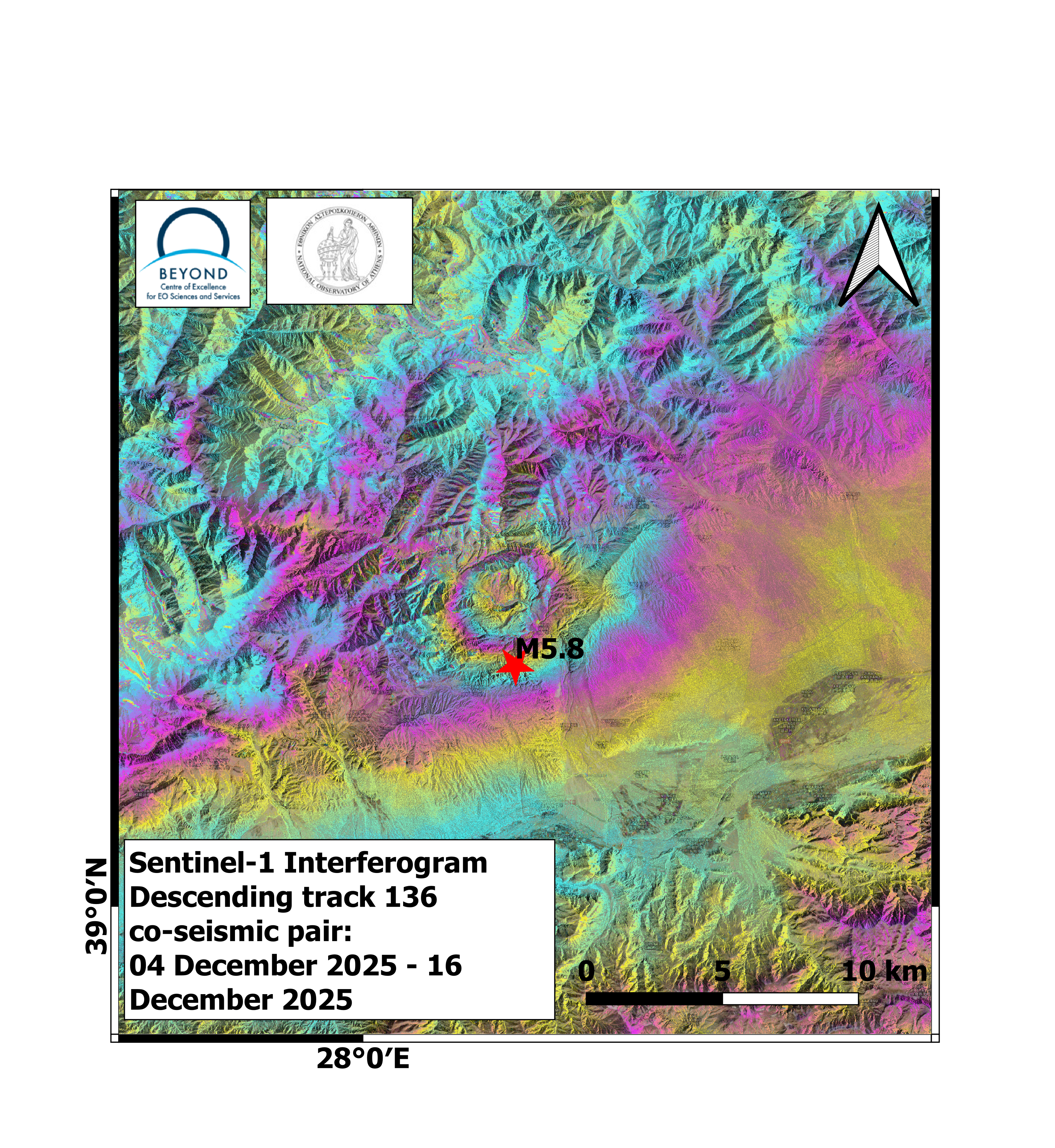
First co-seismic interferograms of Southern Xinjiang, China earthquake (04-12-2025, 07:44:06 UTC).
The GeObservatory service of the Operational Unit BEYOND Center of Earth Observation Research and Satellite Remote Sensing of the National Observatory of Athens, was activated to map ground deformation induced by the Southern Xinjiang, China earthquake, M5.8 of December 4, 2025, 07:44:06 UTC.
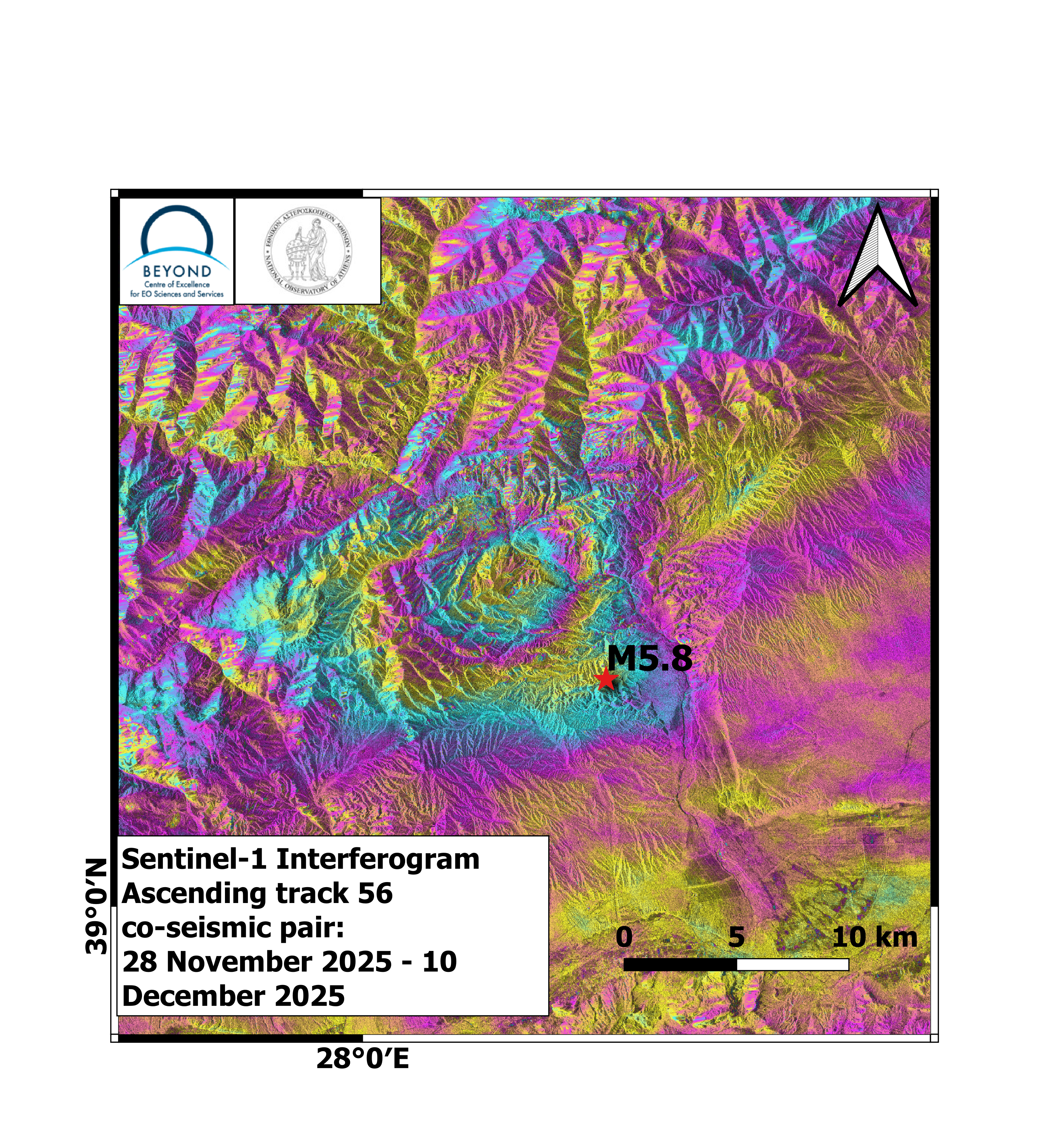
Co-seismic interferograms were produced with the use of Sentinel-1 images of ascending no 56 and descending no136 satellite passes. In the co-seismic interferograms, surface deformation induced by the seismic event is mapped. Each fringe corresponds to a ground deformation equal to 2.8 cm. All co-seismic and pre-seismic interferograms, associated with the event are freely available in the geObsevatory website (http://geobservatory.beyond-eocenter.eu/).
Δορυφορική συμβολομετρική απεικόνιση του πεδίου εδαφικής παραμόρφωσης από τον σεισμό στην Xinjiang, Κίνα (04-12-2025, 07:44:06 UTC).
Η υπηρεσία geObservatory της Επιχειρησιακής Μονάδας BEYOND του Εθνικού Αστεροσκοπείου Αθηνών, ενεργοποιήθηκε και κατέγραψε την εδαφική παραμόρφωση, που προκλήθηκε από τον σεισμό στην Xinjiang στην Κίνα, Μ5.8, στις 4 Δεκεμβρίου 2025, στις 07:44:06 UTC. Δημιουργήθηκαν συμβολογραφήματα με χρήση εικόνων Sentinel-1 ανοδικής και καθοδικής τροχιάς δορυφόρου. . Στα συμβολογραφήματα είναι εμφανείς οι μετατοπίσεις του εδάφους που προκλήθηκαν από τον σεισμό. Κάθε κροσσός συμβολής αντιστοιχεί σε εδαφική παραμόρφωση ίση με 2.8 εκ. Όλα τα διαφορικά συμβολογράμματα που σχετίζονται με τον σεισμό, είναι διαθέσιμα στην ιστοσελίδα του geΟbsevatory (http://geobservatory.beyond-eocenter.eu/).