
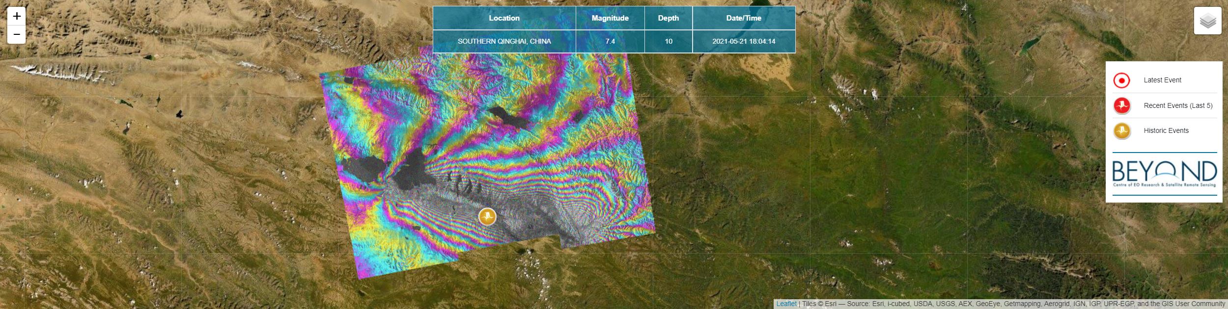
Co-seismic deformation induced by a strong earthquake on May 21, 2021, 18:04:14 UTC of M7.4, in Southern Qinghai, China, was mapped by geObservatory service of BEYOND Center of Earth Observation Research and Satellite Remote Sensing of the National Observatory of Athens. Co-seismic interferograms were generated from Sentinel-1 SLC images of ascending track 99 and descending track 106, of May 20, 2021 and May 26, 2021. Each fringe in the interferograms corresponds to ground deformation equal to 2.8 cm. All co-seismic and pre-seismic interferograms, associated with the event are freely available in the geObsevatory website (http://geobservatory.beyond-eocenter.eu/). The website will be updated with new interferograms as long as new Sentinel-1 satellite data becomes available at the Hellenic Mirror Site.