
RAPID ASSESSMENT OF EARTHQUAKE DAMAGES AT VERY LARGE SCALE
From the recent earthquakes on the Greek island of Kefalonia, it became apparent that UAV technology can assist in mapping damages following a catastrophic event and assessing the Mercalli Intensity of the earthquake.
BEYOND, in collaboration with Geotech LTD (dealer of the Gatewing UAV in Greece) flew a mission over the urban area of Lixouri, five semi-urban areas (Vouni, Mantzavinata, Soullari, Agios Dimitrios and Livadi) and two rural areas (close to the road connecting Lixouri and Argostoli). Geotech LTD provided orthorectified images for each region. BEYOND team imported the images to a GIS and a point database was built in an attempt to detect and classify earthquake related damages. Three types of damages were monitored via simple ortho-interpretation: damages a) on ground level such as damages on roads, harbor infrastructure, cemeteries etc. and also small landslides, b) on walls and c) on roof-tops. This process was done via simple photo-interpretation.
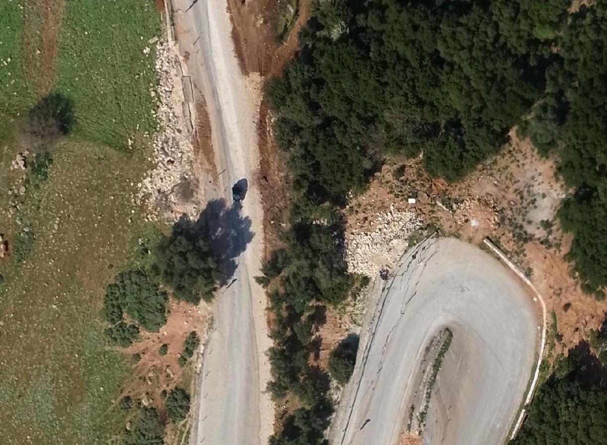 Damages on gound level - Small landslides and cracks on the road connecting Lixouri to Argostoli
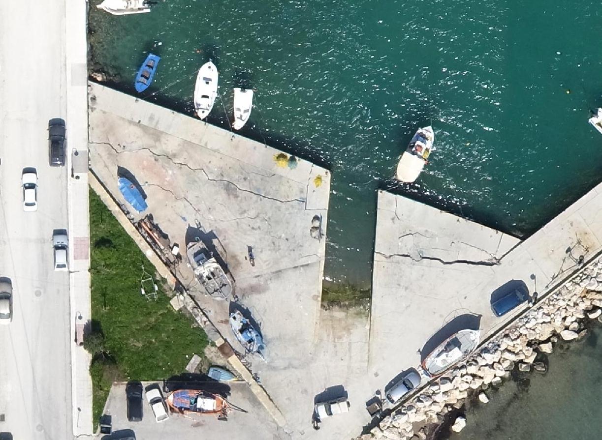 Damages on gound level - Cracked pier at Lixouri
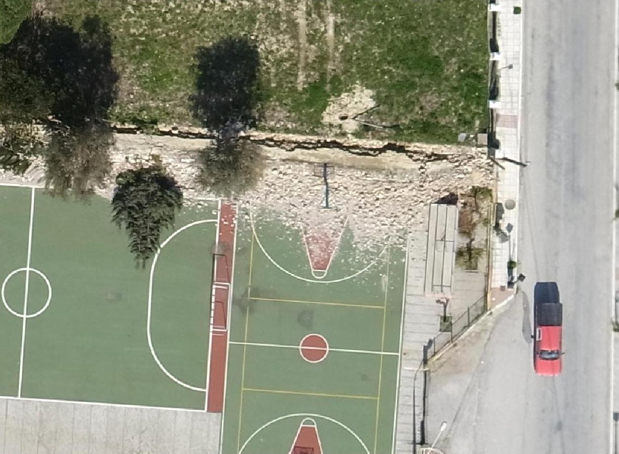 Damages on walls - Fallen support wall and tree at a basketball field at Lixouri
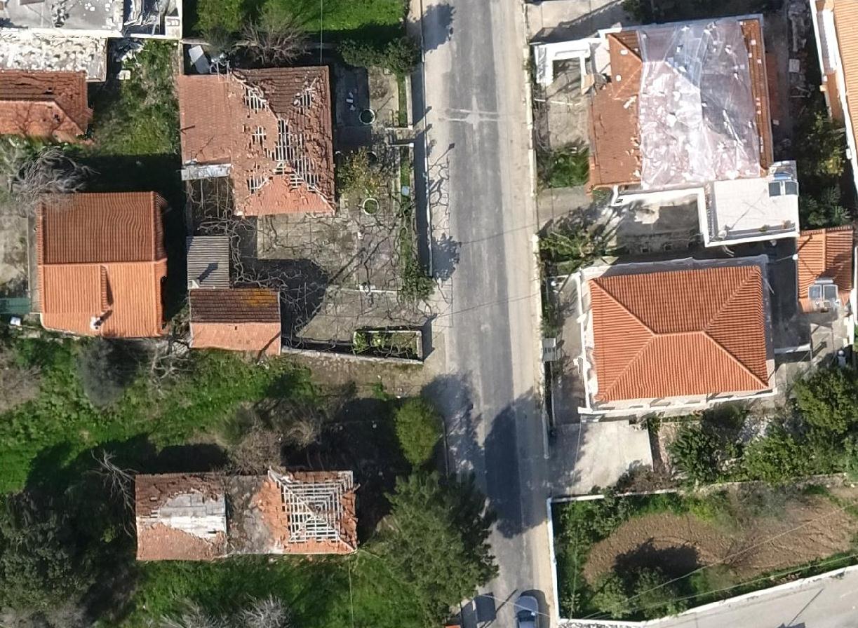 Damages on roof-tops - Damaged roof-tops at Livadi village
At a next level BEYOND will assess the Intensity of the earthquake in the Mercalli scale, based on the density of the damages, thus making the final intensity value more robust.
The service is currently being enhanced by developing in-house software for automatically generating ortho-images from UAV images as to be able to quickly assess the Mercalli Intensity of future earthquakes. Upon consolidation, this feature will be added to the services available within the BEYOND Project.
PHOTO GALLERY
{gallery layout="fixed" rows=5 cols=6 alignment="before-clear"}disasters/uav/Kefalonia{/gallery}