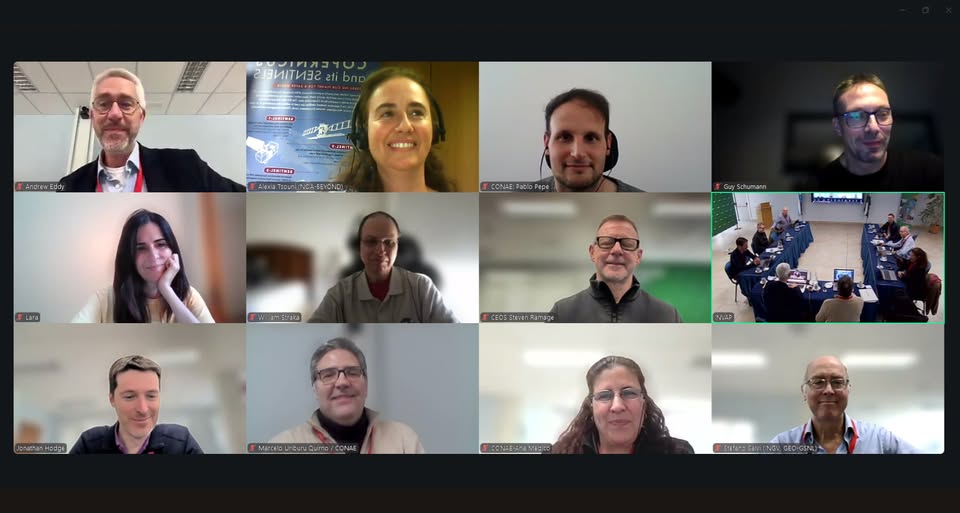
be open

BeOpen Kick-Off Meeting in Naples (Italy), group picture


European consortium launches project to increase availability and usage of open datasets,
leveraging the development of new generation of EU-wide services and AI capabilities

Funded under the Digital Europe Program the BeOpen project is designed to increase the availability, quality and usability of public sector information in compliance with the requirement of the Open Data Directive.

BeOpen will build on existing datasets and expertise throughout the combination of the expertise from previous CEF projects (Interstat, Odala, Spotted and Greenmove), FIWARE platform and leading SMEs/start-ups in the exploitation of data. The project will become a holistic framework that will improve technical data interoperability, semantics and quality of the public sector datasets, easing the creation and validation in real-world conditions of AI services built over existing Open Data.

be open logo

BeOpen, coordinated by Engineering Ingegneria Informática, brings together 18 partners from eight European countries. Eight use cases from 6 countries (Germany, Greece, Italy, Lithuania, Portugal and Spain) will test and validate the framework on the field. Berlin, 3 April 2023 - A consortium of 18 partners, composed of public bodies, large enterprises, SMEs, research institutions and non-profit organisations from eight countries (Belgium, Germany, Greece, Italy, Lithuania, Netherlands, Portugal, and Spain), met last week in Naples (Italy) to officially launch BeOpen, a project funded under the Digital Europe Programme (DIGITAL-2022-CLOUD-AI-02-OPEN-AI) and coordinated by Engineering Ingegneria Informatica, the digital transformation leader in Italy with a global footprint with around 12,000 associates and over 60 offices spread across the globe. BeOpen is born with the aim of supporting public administrations at local, regional and national level in increasing the availability, quality and usability of public sector information (High Value Datasets).

The project outcomes will enable actors, such as SMEs, start-ups, and large companies, as well as public entities, to re-use and combine open public data across the EU for the development of information products and services, including Artificial Intelligence (AI) applications. “The project will develop a holistic framework that will improve data interoperability, semantics and the quality of public sector datasets, easing the creation and validation BeOpen has received funding from European Union's Horizon Europe Research and Innovation programme under the Grant Agreement No 101100807 1 of AI services built over existing Open Data in real-world conditions”, - commented Martino Maggio, project coordinator of BeOpen, Senior Researcher and Project Manager at Engineering Ingegneria Informatica SPA, and added: “Eight use cases in six countries will test and validate the framework over a timeframe of 18 months”.

Strengthening Open Data management and interoperability for Smart Cities BeOpen gathers a large number of innovation experts with proven experience in data interoperability and provisioning of software for data management. Building upon the already available results coming from four Connecting Europe Facility (CEF) projects: INTERSTAT, Spotted, GreenMov, and ODALA that focus their activities on different aspects of Open Data management, BeOpen starts from a solid and tested baseline of technological solutions for the management of different kinds of data and data interoperability.

Moreover, the project aligns with the guiding principles stated in the Living-in.EU declaration by turning EU cities and communities into smart and sustainable places where people enjoy living and working. Making data available as Open Data across the EU Member States BeOpen will support the whole Open Data process lifecycle with the aim of improving the potential of existing and new Open data datasets, maximising their value using them for the creation of IT services.

The project will develop a customisable, cost-saving and easy to use open source ‘toolbox’ that will allow public administrations to manage High Value Datasets, make them available and be reused by any interested stakeholder. The toolbox will also facilitate the publication of those datasets in national and European Open Data Portals. Thanks to the BeOpen toolbox, SMEs, start-ups and large companies will be able to use cross-EU Open Data to scale up and offer EU-wide digital services, such as AI and ML (Machine Learning) based services. This will enable them to benefit from the EU’s digital market opportunities and growth, and ensure the sustainability of the services. BeOpen will be deployed in several municipalities and regions (Attica Region, Cartagena, Herne, Molina de Segura, Napoli, Porto, Torre Pacheco and Vilnius) through the implementation of eight use cases using existing open public sector datasets to test and validate the developed toolbox.

The public actors involved in these use cases will benefit from the developed supporting methodologies and guidelines that accompany the deployment of the toolbox. With the help of BeOpen, all use cases are expected to improve the availability, quality, and usability of public sector information in compliance with the requirement BeOpen has received funding from European Union's Horizon Europe Research and Innovation programme under the Grant Agreement No 101100807 2 of the Open Data Directive, in force since July 2019, and the Implementing Regulation. Ultimately, the outcomes of these real-world pilots will reinforce Europe’s ability to manage urgent societal challenges, as they tackle challenges in relevant areas, such as traffic pollution, air quality, lighting and its impact on health, heatwaves, invading species or unpredictable emergencies such as fires, floods or earthquakes. Additionally, BeOpen will contribute to the common European data spaces ensuring availability of useful data and following Gaia-X principles of highest standards with regards to digital sovereignty.

Read here the project's overview

More about the project: https://beopen-dep.eu/about/ 


Untitled 2048 x 1536 pxΔορυφορική συμβολομετρική απεικόνιση του πεδίου εδαφικής παραμόρφωσης από τον σεισμό στην Αιθιοπία (Μ5.7, 04-01-2025, 00:52:21 UTC).

Εδαφική παραμόρφωση από τον σεισμό Μ5.7, στην Αιθιοπία στις 4 Ιανουαρίου 2025, 00:52:21 UTC, καταγράφηκε από την υπηρεσία geObservatory της Επιχειρησιακής μονάδας «Κέντρο Ερευνών Παρατήρησης της Γης και Δορυφορικής Τηλεπισκόπησης BEYOND» του ΙΑΑΔΕΤ/ΕΑΑ Εθνικού Αστεροσκοπείου Αθηνών. Για το συμβολογράφημα καθοδικής και ανοδικής τροχιάς του δορυφόρου Sentinel-1, χρησιμοποιήθηκαν δορυφορικές εικόνες ανοδικής τροχιάς από τις 5 Δεκεμβρίου 2024 και 10 Ιανουαρίου 2025 και καθοδικής τροχιάς από τις 29 Δεκεμβρίου 2024 και 10 Ιανουαρίου 2025. Στο συμβολογράφημα κάθε κροσσός συμβολής αντιστοιχεί σε εδαφική παραμόρφωση ίση με 2.8 εκ.

Όλα τα διαφορικά συμβολογράμματα που σχετίζονται με τον σεισμό, είναι διαθέσιμα στην ιστοσελίδα του geΟbsevatory.

Εικόνες 1-2: Συμβολογράφημα ανοδικής και καθοδικής τροχιάς δορυφόρου, για τον σεισμό στην Αιθιοπία (Μ5.7, 04-01-2025, 00:52:21 UTC).

.........................................................................................................................................................................................................................

First co-seismic interferogram of Ethiopia earthquake (Μ5.7, 04-01-2025, 00:52:21 UTC).

Co-seismic deformation from Μ5.7 Ethiopia earthquake in January 04, 2025, 00:52:21 UTC, was mapped by the geObservatory service of the Operational Unit BEYOND Center of Earth Observation Research and Satellite Remote Sensing of the National Observatory of Athens. Co-seismic interferograms of ascending satellite pass no.87 and descending satellite pass no.79 of Sentinel-1 sensor, were produced. Images of December 5, 2024 and January 10, 2025 were processed for the ascending track and from December 29, 2024 and January 10, 2025 from the descending track. In the produced interferogram, each fringe corresponds to a ground deformation equal to 2.8 cm.

All co-seismic and pre-seismic interferograms, associated with the event are freely available in the geObsevatory website.

Figure 1-2: Co-seismic interferogram of ascending and descending track for Ethiopia earthquake (Μ5.7, 04-01-2025, 00:52:21 UTC)

ethiopia 1

ethiopia2


BEYOND ft North Macedonia 2

Το BEYONDedu ταξιδεύει στα σχολεία της Βόρειας Μακεδονίας!

Είμαστε στην ευχάριστη θέση να ανακοινώσουμε τη συνεργασία μας με την Πρεσβεία της Ελλάδας στη Βόρεια Μακεδονία, με στόχο να μεταφέρουμε τη γνώση πέρα από τα σύνορα, δημιουργώντας γέφυρες εκπαίδευσης και καινοτομίας.

Μέσα από το πρόγραμμα BEYONDedu, μαθητές και μαθήτριες πρωτοβάθμιας και δευτεροβάθμιας εκπαίδευσης ανακαλύπτουν τον συναρπαστικό κόσμο της δορυφορικής τηλεπισκόπησης και μαθαίνουν πώς να χρησιμοποιούν δορυφορικά δεδομένα για την παρακολούθηση του περιβάλλοντος και τη διαχείριση γεωκινδύνων.

Τι περιλαμβάνει το πρόγραμμα:

  • Εισαγωγή στη δορυφορική τηλεπισκόπηση
  • Εφαρμογές για περιβαλλοντική παρακολούθηση και φυσικές καταστροφές
  • Χρήση εργαλείων όπως το EO Browser για επεξεργασία δεδομένων

Θα θέλαμε να ευχαριστήσουμε θερμά την Πρέσβη της Ελλάδας στη Βόρεια Μακεδονία, κα. Σοφία Φιλιππίδου, για την πρωτοβουλία να φέρει το εκπαιδευτικό πρόγραμμα BEYONDedu στα σχολεία της Βόρειας Μακεδονίας.

Η συνεργασία αυτή ενισχύει την αποστολή μας να εμπνέουμε τη νέα γενιά να αγκαλιάσει την επιστήμη, την τεχνολογία και την περιβαλλοντική ευαισθησία, προάγοντας τη γνώση χωρίς σύνορα.

 Sizangk

Δορυφορική συμβολομετρική απεικόνιση του πεδίου εδαφικής παραμόρφωσης από τον σεισμό στη Σιζάνγκ (Μ7.1, 07-01-2025, 01:05:17 UTC).

Εδαφική παραμόρφωση από τον σεισμό Μ7.1, στη Σιζάνγκ στις 7 Ιανουαρίου 2025, 01:05:17 UTC, καταγράφηκε από την υπηρεσία geObservatory της Επιχειρησιακής μονάδας «Κέντρο Επιστημών Παρατήρησης της Γης και Δορυφορικής Τηλεπισκόπησης BEYOND» του ΙΑΑΔΕΤ/ΕΑΑ Εθνικού Αστεροσκοπείου Αθηνών. Συμβολογράφημα καθοδικής τροχιάς του δορυφόρου Sentinel-1, δημιουργήθηκε με χρήση εικόνων από τις 27 Δεκεμβρίου 2024 και 8 Ιανουαρίου 2025. Στο συμβολογράφημα κάθε κροσσός συμβολής αντιστοιχεί σε εδαφική παραμόρφωση ίση με 2.8 εκ.

Όλα τα διαφορικά συμβολογράμματα που σχετίζονται με τον σεισμό, είναι διαθέσιμα στην ιστοσελίδα του geΟbsevatory (http://geobservatory.beyond-eocenter.eu/).


First co-seismic interferogram of Western Xizang earthquake (Μ7.1, 07-01-2025, 01:05:17 UTC).

Co-seismic deformation from Μ7.1 Western Xizang earthquake in January 07, 2025, 01:05:17 UTC, was mapped by the geObservatory service of the Operational Unit BEYOND Center of Earth Observation Research and Satellite Remote Sensing of the National Observatory of Athens. Co-seismic interferogram of descending satellite pass no.48 of Sentinel-1 sensor, was produced with the use of two images of December 27, 2024 and January 8, 2025. In the produced interferogram, each fringe corresponds to a ground deformation equal to 2.8 cm.

All co-seismic and pre-seismic interferograms, associated with the event are freely available in the geObsevatory website (http://geobservatory.beyond-eocenter.eu/).


Figure 1: Co-seismic interferogram of descending track 48 of Western Xizang earthquake (Μ7.1, 07-01-2025, 01:05:17 UTC)

Εικόνα 1: Συμβολογράφημα καθοδικής τροχιάς δορυφόρου, για τον σεισμό στη Σιζάνγκ (Μ7.1, 07-01-2025, 01:05:17 UTC).


 ΕΚΘΕΣΗ ΔΡΑΣΤΗΡΙΟΤΗΤΩΝ 2023


 Διαβάστε εδώ την Ετήσια Έκθεση Δραστηριοτήτων της Επιχειρησιακής Μονάδας BEYOND για το Έτος 2023 

 STEMMOS2


STEMMOS Project Kick-off Meeting in Vienna

Satellite Observation of Earth, Moon and Mars in Schools 

BEYOND/NOA was excited to participate in the Kick-off meeting of the STEMMOS Project, which was held on 10 December 2024, in Vienna, Austria

During the Kick-off meeting, our Project Managers team Dr.  Foteini Salta & Mrs Maria (Marietta) Papakonstantinou presented the activities of WP3, which is lead by BEYOND/NOA.

The STEMMOS project aims to design, develop, and evaluate an innovative educational program to empower trainers in teaching Earth, Moon, and Mars Observations (EMMO) science. This initiative targets to enhance students' STEAM capabilities and soft skills while promoting a deeper appreciation of space science.

The main role of BEYOND/NOA in STEMMOS is to coordinate the activities of WP3, which focuses on developing a comprehensive training package comprising of four modules. These modules aim to equip trainers with the essential skills and expertise to effectively teach EMMO-related subjects.

BEYOND/NOA is responsible for two specific modules:
“Observing Earth from Space” and
“From Data to Applications”.

Additionally, BEYOND/NOA will contribute to the development of the STEMMOS Hub, which will feature online games and tools sourced from various platforms. Our team will also support the implementation of training sessions for teachers and students. Last but not least, we will oversee clustering activities in collaboration with other projects and initiatives to ensure alignment and synergy.

We are excited to contribute to the successful implementation of this project and foster a deeper appreciation of space science in schools by empowering school communities.


STEMMOS Project is Funded by hashtag#ERAMUS+ Co-funded by the European Union

Discover more:
http://beyond-eocenter.eu/index.php/projects/projects-list/718-stemmos-satellite-observation-of-earth-moon-and-mars-in-schoolss


 trise 1

Συμμετοχή της Επιχειρησιακής Μονάδας BEYOND του ΙΑΑΔΕΤ/ΕΑΑ σε δημόσια εκδήλωση-συζήτηση με τίτλο «Ο κίνδυνος των πλημμυρών στην Αττική & η ανάγκη υπεράσπισης των ρεμάτων», 19/12/2024

Με επιτυχία διοργανώθηκε η δημόσια εκδήλωση-συζήτηση με τίτλο «Ο κίνδυνος των πλημμυρών στην Αττική & η ανάγκη υπεράσπισης των ρεμάτων» που διοργάνωσε η Αυτενέργεια, στο Διεθνές Ινστιτούτο Κοινωνικής Οικολογίας TRISE, την Πεμπτη 19 Δεκεμβρίου 2024.

Στην εκδήλωση μίλησαν:

✔️ Ο Δημήτρης Μουστάκης, μέλος της Αυτενέργειας.

✔️ Ο Δημήτρης Θεοδοσόπουλος, Αγρονόμος - Τοπογράφος Μηχανικός ΕΜΠ, μέλος της ομάδας έρευνας & μελέτης ΓΕΩΜΥΘΙΚΗ.

✔️ H Αλεξία Τσούνη, Πολιτικός Μηχανικός ΕΜΠ, Επιστημονική Συνεργάτιδα της Επιχειρησιακής Μονάδας BEYOND του ΙΑΑΔΕΤ/ΕΑΑ.

Η Αλεξία Τσούνη παρουσίασε τα αποτελέσματα του έργου "Εκτίμηση Κινδύνου Πλημμύρας στην Περιφέρεια Αττικής" στο πλαίσιο της σχετικής Προγραμματικής Σύμβασης (2021-2024), καθώς και την επείγουσα εκτίμηση κινδύνων πλημμύρας- διάβρωσης-κατολίσθησης στις λεκάνες απορροής που επλήγησαν περισσότερο από τις μεγάλες δασικές πυρκαγιές της Αττικής (2021).

Ακολούθησε ανοιχτή συζήτηση με το κοινό.


trise2


  19 12 24


FINAL 


GreCO Project Kick-off Meeting in Athens, 16/12/2024

BEYOND/NOA was excited to participate in the Kick-off meeting of the GreCO Project which was held on 16 December 2024, in Athens, Greece

GreCO is a pioneering collaborative approach to proactive urban tourism planning, crafting immersive, sustainable, culturally enriched experiences for all. GreCO offers innovative and personalized routes and educational programs that actively engage stakeholders and represents a groundbreaking, inclusive and original approach to proactive urban tourism planning. It combines sustainability, cultural diversity, and digital innovations to create a resilient, inclusive, and sustainable tourism ecosystem.

During the Kick-off meeting our Project Manager Dr Foteini Salta presented the main roles and activities of BEYOND/NOA team within the project.
The main role of BEYOND/NOA in GreCO focuses on Big Data integration and AI-driven modeling. Leveraging its expertise, our team will integrate sensor data spatio-temporally and develop advanced Machine Learning pipelines and algorithms. These tools will model current and future environmental impacts of urban routes, providing a comprehensive understanding of sustainability challenges across the city. As part of its responsibilities, BEYOND/NOA will create sustainability indicators and maps, with a focus on air and noise pollution levels. These indicators will not only quantify the project's impact on sustainability but also guide future actions and strategies aimed at enhancing urban environmental health.

We look forward to contributing to the successful implementation of this project and and supporting the development of innovative solutions that promote a sustainable and healthier urban environment.


A warm thank you to the project's coordinator Municipality of Elliniko-Argyroupoli for organizing and hosting such a great event!

GreCO Project is Funded by EUROPEAN URBAN INITIATIVE | Co-funded by the European Union.


nevadaFirst co-seismic interferogram of Nevada earthquake (Μ5.8, 09-12-2024, 23:08:33 UTC)

Co-seismic deformation from Μ5.8 Nevada earthquake in December 09, 2024, 23:08:33 UTC, was mapped by the geObservatory service of the Operational Unit BEYOND Center of Earth Observation Research and Satellite Remote Sensing of the National Observatory of Athens. Co-seismic interferogram of ascending satellite pass no.64 of Sentinel-1 sensor, was produced with the use of two images of December 4, 2024 and December 16, 2024. In the produced interferogram, each fringe corresponds to a ground deformation equal to 2.8 cm. All co-seismic and pre-seismic interferograms, associated with the event are freely available in the geObsevatory website (http://geobservatory.beyond-eocenter.eu/).

Δορυφορική συμβολομετρική απεικόνιση του πεδίου εδαφικής παραμόρφωσης από τον σεισμό στην Νεβάδα (Μ5.8, 09-12-2024, 23:08:33 UTC)

Εδαφική παραμόρφωση από τον σεισμό Μ5.8, στην Νεβάδα στις 9 Δεκεμβρίου 2024, 23:08:33 UTC, καταγράφηκε από την υπηρεσία geObservatory της Επιχειρησιακής μονάδας «Κέντρο Επιστημών Παρατήρησης της Γης και Δορυφορικής Τηλεπισκόπησης BEYOND» του ΙΑΑΔΕΤ/ΕΑΑ Εθνικού Αστεροσκοπείου Αθηνών. Συμβολογράφημα ανοδικής τροχιάς του δορυφόρου Sentinel-1, δημιουργήθηκε με χρήση εικόνων από τις 4 Δεκεμβρίου 2024 και 16 Δεκεμβρίου 2024. Στο συμβολογράφημα κάθε κροσσός συμβολής αντιστοιχεί σε εδαφική παραμόρφωση ίση με 2.8 εκ. Όλα τα διαφορικά συμβολογράμματα που σχετίζονται με τον σεισμό, είναι διαθέσιμα στην ιστοσελίδα του geΟbsevatory (http://geobservatory.beyond-eocenter.eu/).


Figure 1: Co-seismic interferogram of ascending track 64 of Nevada earthquake (Μ5.8, December 09, 2024, 23:08:33 UTC).

Εικόνα 1: Συμβολογράφημα ανοδικής τροχιάς δορυφόρου, για τον σεισμό στην Νεβάδα (Μ5.8, 9 Δεκεμβρίου 2024, 23:08:33 UTC).