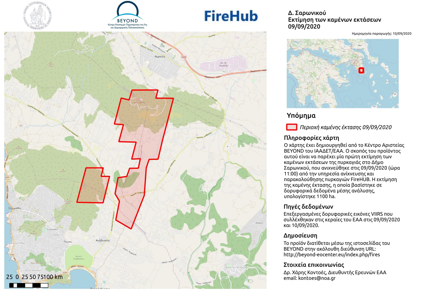
Πρώτος απολογισμός της πυρκαγιάς στην Κερατέα Αττικής, 9 Σεπτεμβρίου 2020.
Πρώτος απολογισμός της πυρκαγιάς στην Κερατέα Αττικής, 9 Σεπτεμβρίου 2020.
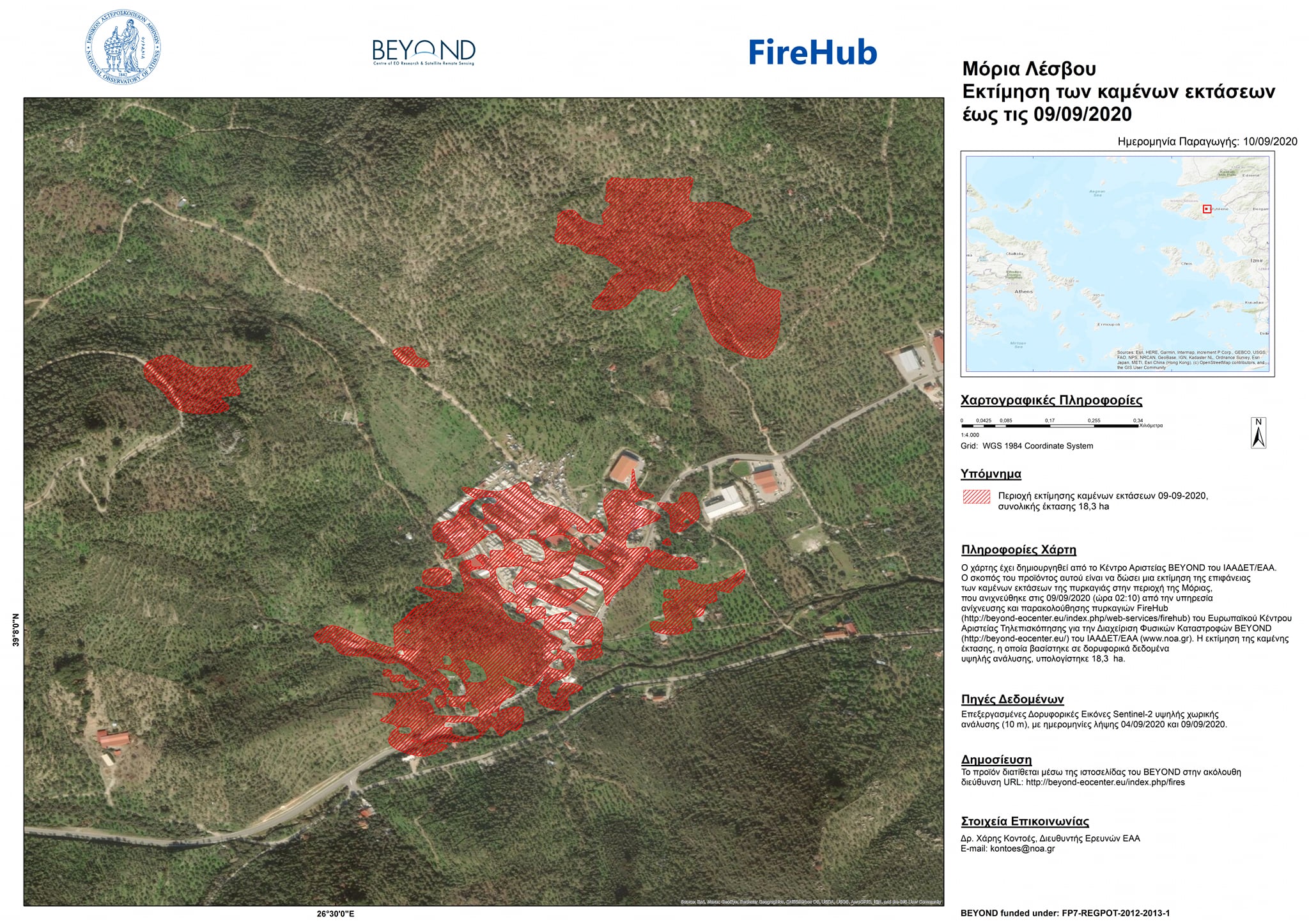
To Κέντρο Επιστημών Παρατήρησης της Γης και Δορυφορικής Τηλεπισκόπησης BEYOND του ΙΑΑΔΕΤ/ Εθνικό Αστεροσκοπείο Αθηνών δημοσιεύει σήμερα περισσότερα στοιχεία για την πυρκαγιά που ξέσπασε στη Μόρια της Λέσβου.
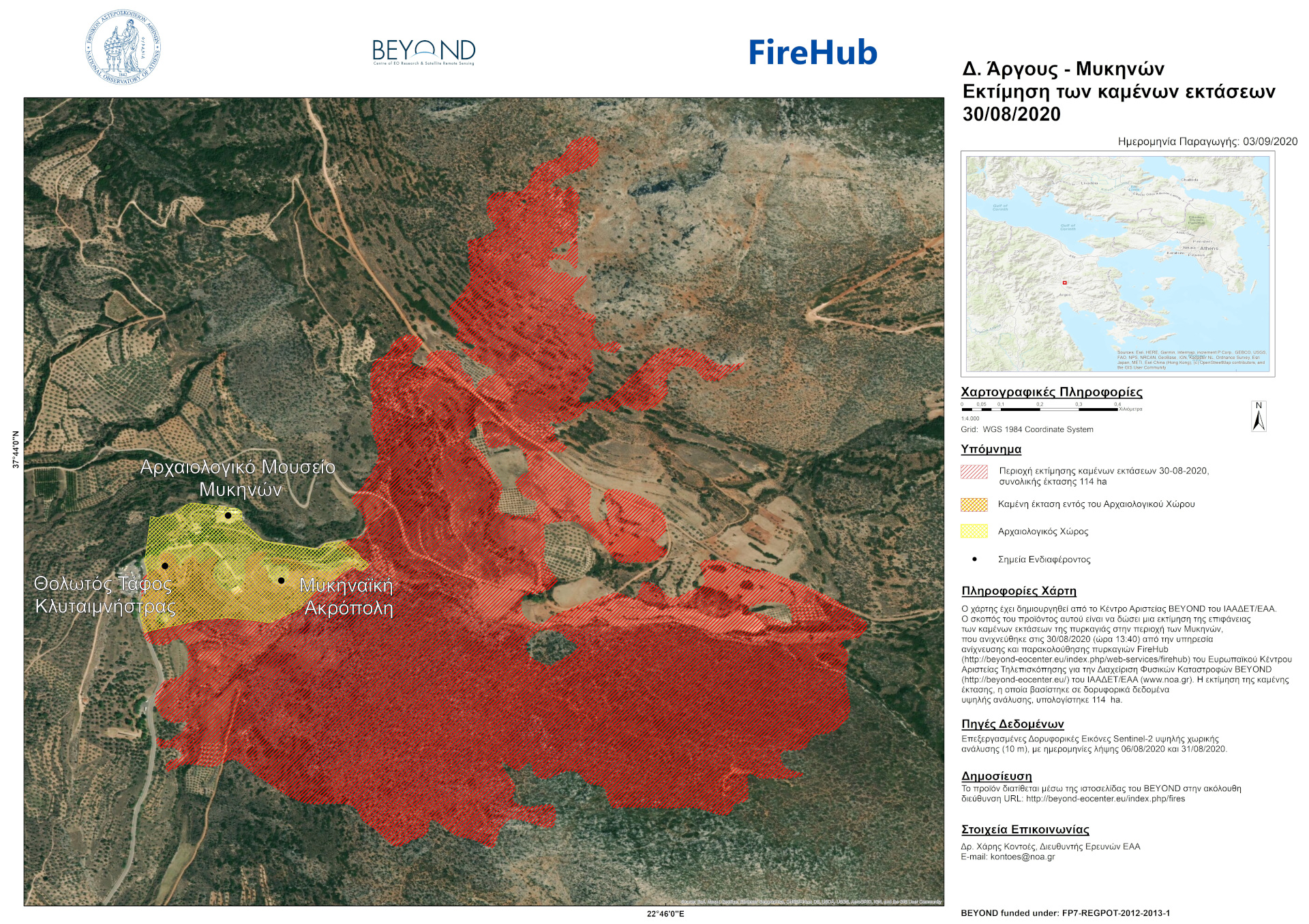
To Κέντρο Επιστημών Παρατήρησης της Γης και Δορυφορικής Τηλεπισκόπησης BEYOND του ΙΑΑΔΕΤ/ Εθνικό Αστεροσκοπείο Αθηνών δημοσιεύει σήμερα περισσότερα στοιχεία για την μεγάλη πυρκαγιά που ξέσπασε στις 30 Αυγούστου 2020 στην Δ/Ε Μυκηναίων του δήμου Άργους-Μυκηνών.
The BEYOND Center of Earth Observation Research and Satellite Remote Sensing of the National Observatory of Athens, publishes today a report that sheds light on the fire that broke out on August 30, 2020 in the Municipality of Argos- Mycenae, which hit a significant part of the Mycenaean archeological UNESCO site.
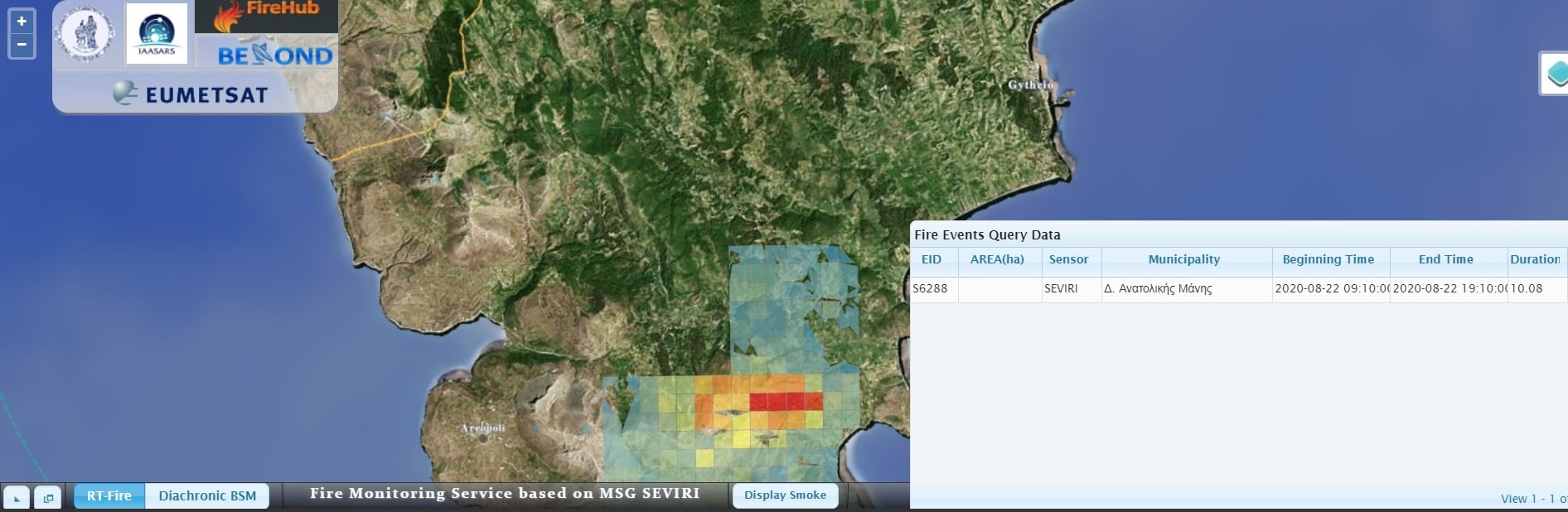
To Κέντρο Επιστημών Παρατήρησης της Γης και Δορυφορικής Τηλεπισκόπησης BEYOND του ΙΑΑΔΕΤ/ Εθνικό Αστεροσκοπείο Αθηνών δημοσιεύει σήμερα περισσότερα στοιχεία για την μεγάλη πυρκαγιά που ξέσπασε στις 22 Αυγούστου 2020 στη δασική περιοχή Λαγκάδα του δήμου Ανατολικής Μάνης Λακωνίας.
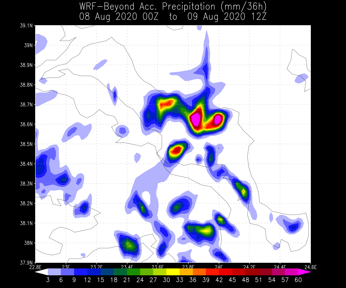
Οι έντονες βροχοπτώσεις πάνω από την Εύβοια κατά τη διάρκεια των τελευταίων 36 ωρών (08 Αυγούστου 2020 00UTC έως 09 Αυγούστου 2020 12UTC) είχαν ως αποτέλεσμα 5 ανθρώπινες απώλειες μέχρι αυτή τη στιγμή.
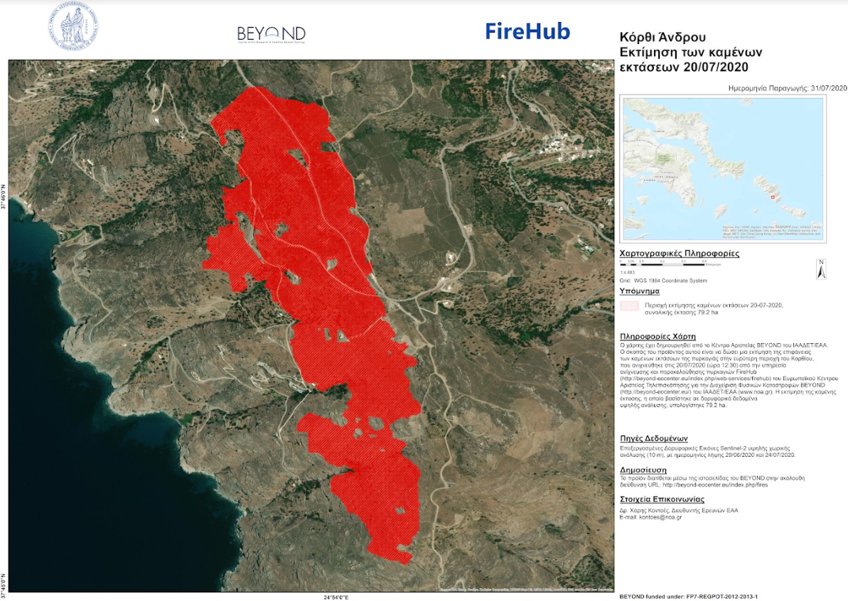
To Kέντρο Αριστείας BEYOND του Εθνικού Αστεροσκοπείου Αθηνών μέσω του συστήματος #FIREHUB εντόπισε την έναρξη της πυρκαγιάς στην περιοχή Κορθίου της Άνδρου από τα πρώτα κιόλας λεπτά που εκδηλώθηκε, 20/07/2020, ώρα 12:30 τοπική.
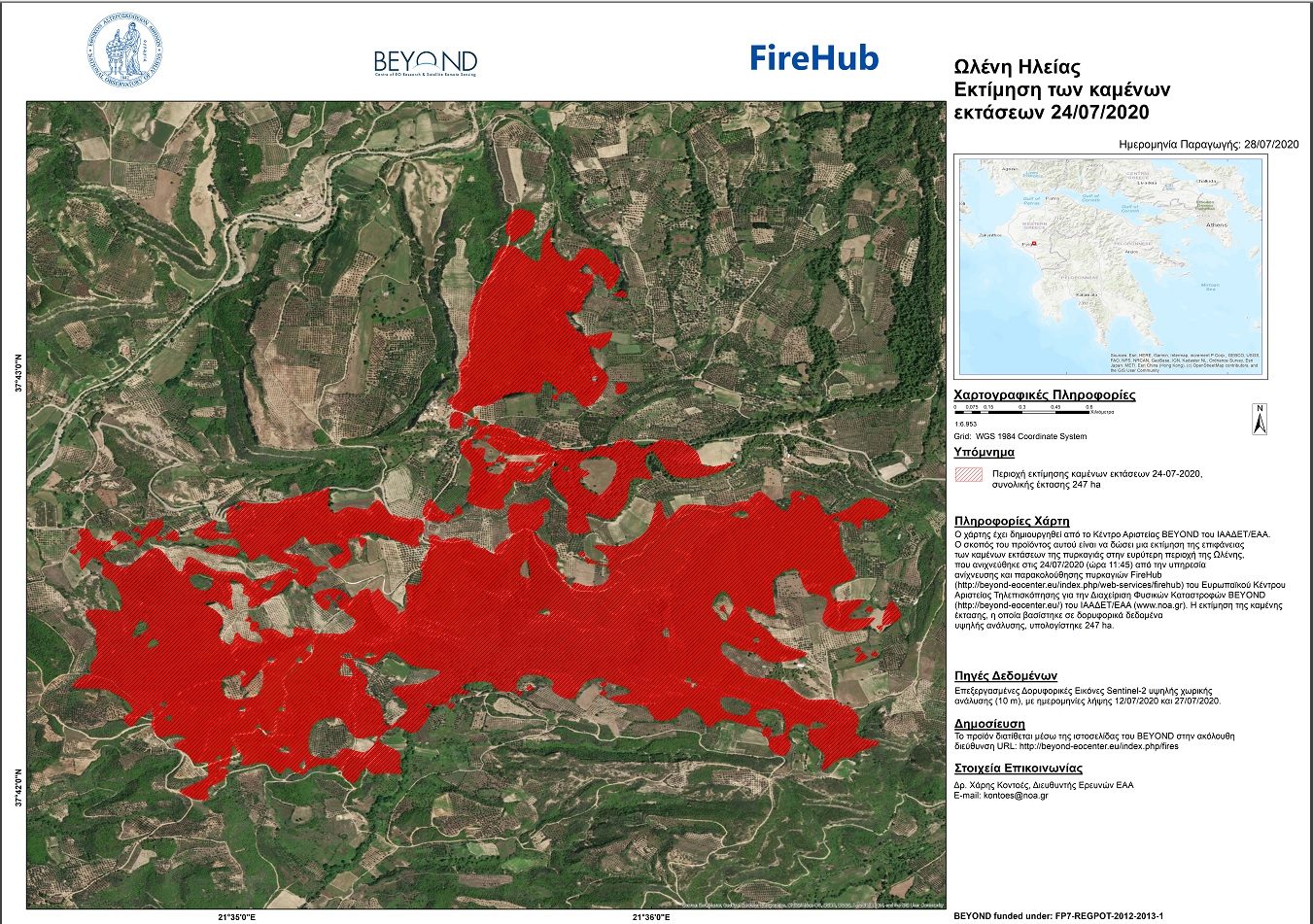
To Kέντρο Αριστείας BEYOND του Εθνικού Αστεροσκοπείου Αθηνών μέσω του συστήματος #FIREHUB εντόπισε την έναρξη της πυρκαγιάς στην περιοχή Ωλένη Ηλείας από τα πρώτα κιόλας λεπτά που εκδηλώθηκε, 24/07/2020, ώρα 11:45 τοπική.
Συνέντευξη του Δρ. Χάρη Κοντοέ στο περιοδικό NetFAX και συγκεκριμένα στον δημοσιογράφο Γιάννη Ριζόπουλο.
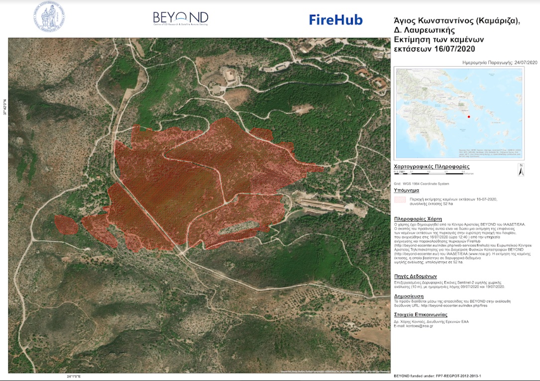
To Kέντρο Αριστείας BEYOND του Εθνικού Αστεροσκοπείου Αθηνών μέσω του συστήματος #FIREHUB εντόπισε την έναρξη της πυρκαγιάς στην περιοχή του Κάτω Σουνίου στο Λαύριο από τα πρώτα κιόλας λεπτά που εκδηλώθηκε (12.40 , τοπική ώρα).