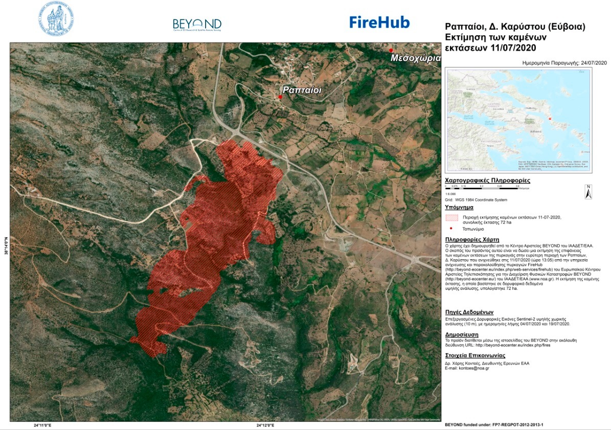
To Kέντρο Αριστείας BEYOND του Εθνικού Αστεροσκοπείου Αθηνών μέσω του συστήματος #FIREHUB εντόπισε την έναρξη της πυρκαγιάς στην περιοχή του Δήμου Καρύστου από τα πρώτα κιόλας λεπτά που εκδηλώθηκε (13.05 , τοπική ώρα).
To Kέντρο Αριστείας BEYOND του Εθνικού Αστεροσκοπείου Αθηνών μέσω του συστήματος #FIREHUB εντόπισε την έναρξη της πυρκαγιάς στην περιοχή του Δήμου Καρύστου από τα πρώτα κιόλας λεπτά που εκδηλώθηκε (13.05 , τοπική ώρα).
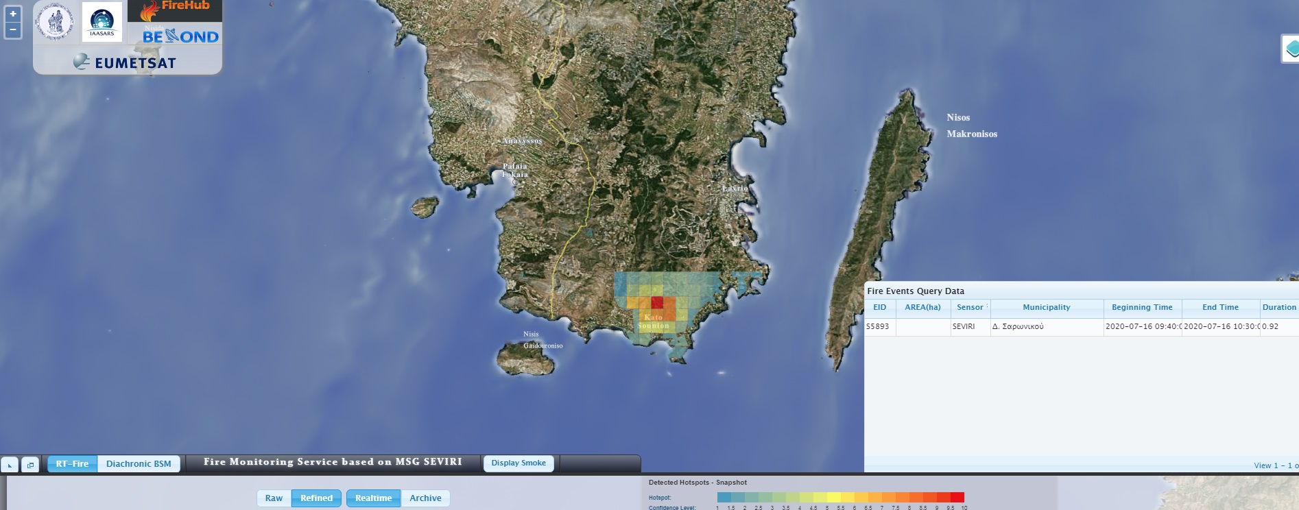
To Kέντρο Αριστείας BEYOND του Εθνικού Αστεροσκοπείου Αθηνών μέσω του συστήματος #FIREHUB εντόπισε την έναρξη της πυρκαγιάς στην περιοχή του Κάτω Σουνίου στο Λαύριο από τα πρώτα κιόλας λεπτά που εκδηλώθηκε (12.40 , τοπική ώρα).
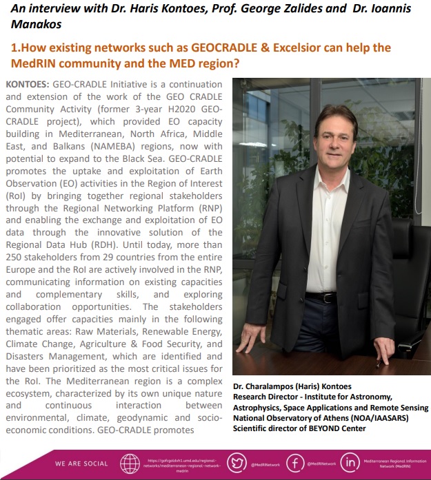
Read Dr. Haris Kontoes interview about GEO-CRADLE intiative and BEYOND Center of Earth Observation Research and Satellite Remote Sensing!
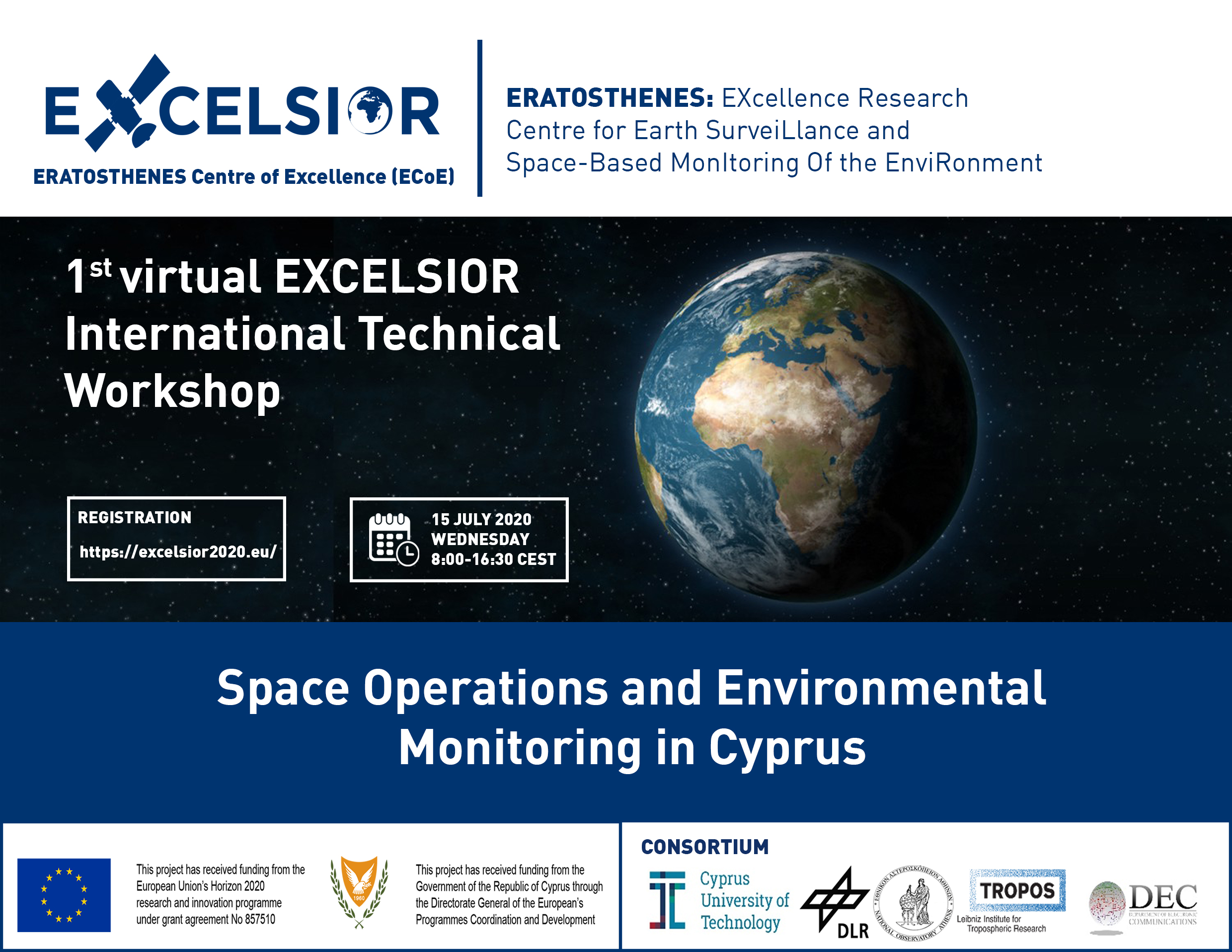
Space Operations and Environmental Monitoring in Cyprus |Wednesday, July 15th 2020, 08:00 – 16.30 CEST

ΠΡΟΣΚΛΗΣΗ ΕΚΔΗΛΩΣΗΣ ΕΝΔΙΑΦΕΡΟΝΤΟΣ για την Πλήρωση μίας (1) Θέσης Εξωτερικού Συνεργάτη(Κωδικός Θέσης: ΠΕDS4)στο Πλαίσιο του Έργου με Τίτλο«EUROGEOSS Showcases: Applications powered by Europe (E-SHAPE)» που χρηματοδοτείται από την Ευρωπαϊκή Επιτροπή.
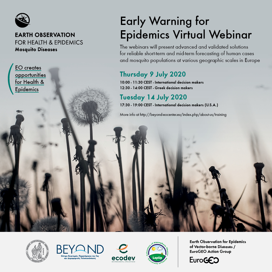
A virtual workshop for "Early Warning for Epidemics" July 9th and 14th, 2020.
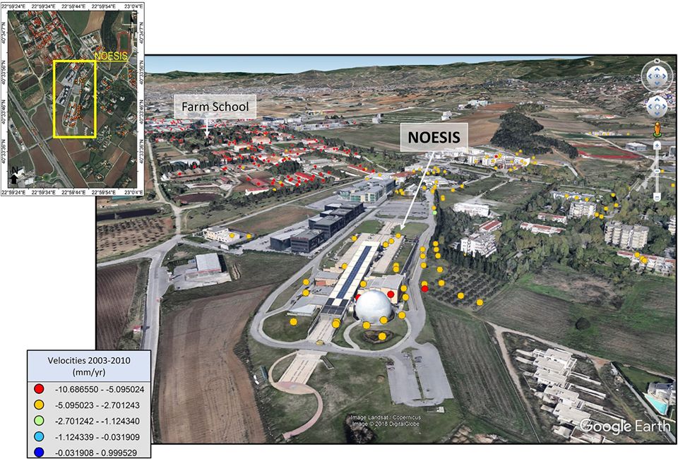
Interesting findings in our recent BEYOND publication!
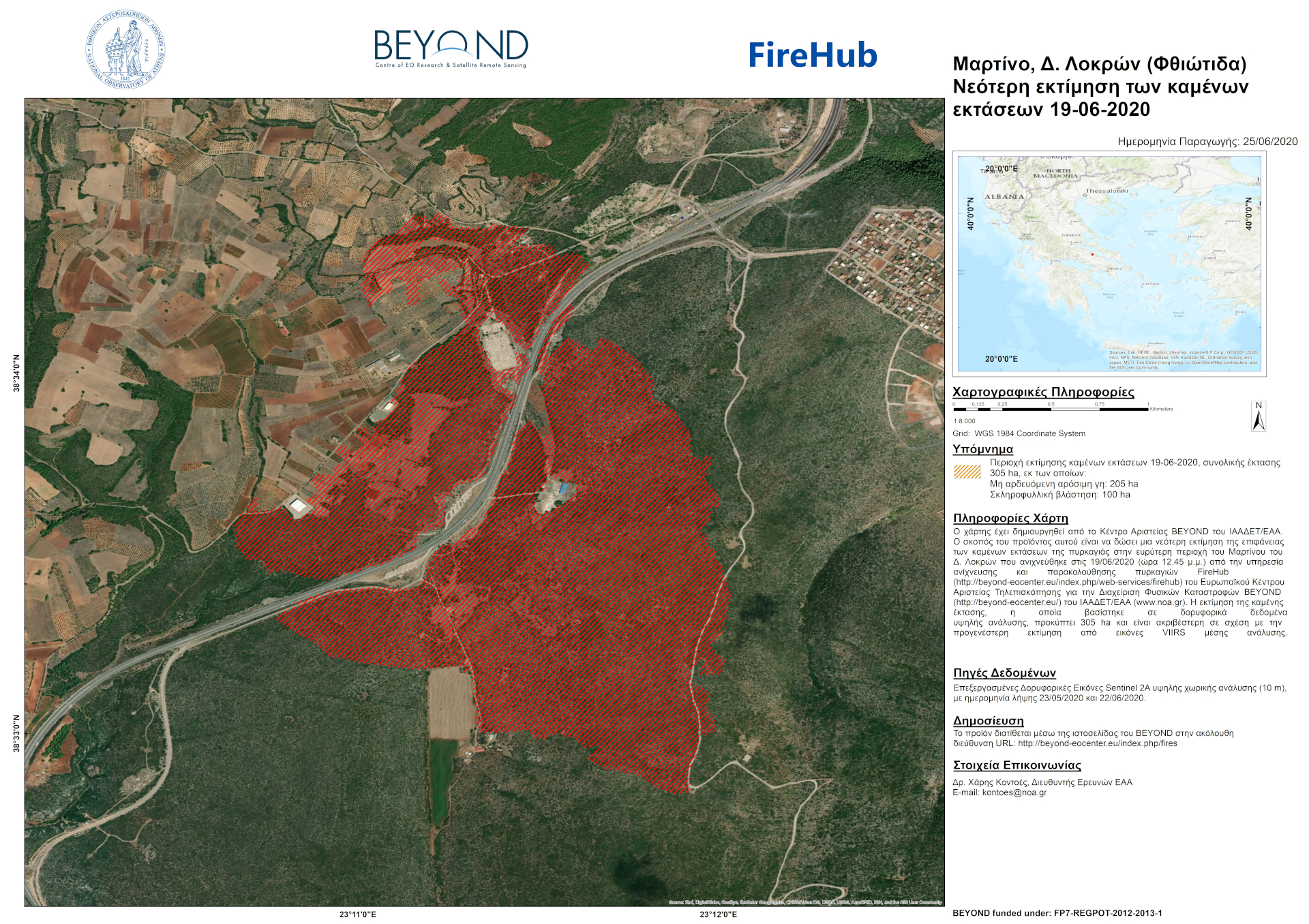
Νεότερη εκτίμηση των καμένων εκτάσεων στην ευρύτερη περιοχή του Μαρτίνου (Δ. Λοκρών, Φθιώτιδα) από την πυρκαγιά της 19ης Ιουνίου 2020 - Latest estimation of the burned areas in the greater area of Martino (Mun. of Lokroi, Phthiotis) from the fire of June 19, 2020.
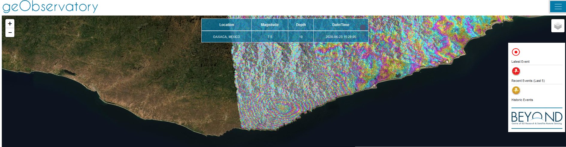
First co-seismic ascending interferogram for the 2020.06.23, M7.4 Santa María Zapotitlán, earthquake in Mexico. All interferograms that cover the event are available to download from BEYOND’s geObservatory service: http://geobservatory.beyond-eocenter.eu.
![]()
Initiation of 3 new, thematic working groups within GEO, June 2020
Three new, thematic working groups within GEO were formed and Greece is actively represented through highly esteemed members of its EO community.