The Mediterranean region is facing an alarming rise in the frequency and severity of wildfires, threatening ecosystems, communities, and livelihoods. In response, BEYOND Centre of Earth Observation Research and Satellite Remote Sensing (BEYOND/NOA) is proud to coordinate the MedFireWise Project—a new, ambitious 36-month project under the Interreg NEXT MED programme aimed at advancing wildfire risk management across the Mediterranean basin.
Launched on June 18, 2025, and co-funded by the European Union, the MedFireWise Project promotes Nature-based Solutions (NbS)—namely prescribed burning and silvopasture—as sustainable and scientifically supported practices to mitigate wildfire risk and strengthen ecosystem resilience.

We're excited to announce that the successful collaboration between our team from NOA/BEYOND, NTUA, and IDCOM, under the supervision of JRC CEMS, has resulted in valuable scientific insights on post-wildfire vegetation recovery surveillance in Sierra Bermeja, Spain. State of vegetation and forest mass, erosion risk, landslide risk and road network accessibility mapping were assessed in order to monitor the recovery of the environment and to provide information on the risk to accommodate the use and services of the impacted territory.
Read more: CEMS Activation: Post-wildfire vegetation recovery surveillance in Sierra Bermeja, Spain
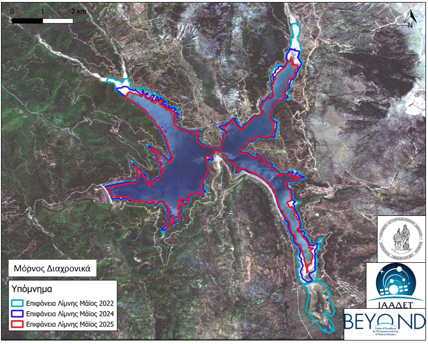
Σκοπός της ανάλυσης
Το υδροδοτικό σύστημα της Αττικής αντλεί νερό από τέσσερις βασικούς ταμιευτήρες: Μόρνος, Εύηνος, Υλίκη, και Μαραθώνας. Από αυτούς:
- Ο Μόρνος είναι η κύρια πηγή ύδρευσης, εξυπηρετώντας τη μεγαλύτερη κατανάλωση.
- Ο Εύηνος ενισχύει τον Μόρνο μέσω της σήραγγας Ευήνου-Μόρνου, λειτουργώντας ως μεταβατικός ταμιευτήρας.
- Η Υλίκη (φυσική λίμνη) και ο Μαραθώνας λειτουργούν συμπληρωματικά στους δύο κύριους ταμιευτήρες.
Η υπηρεσία FloodHUB της Επιχειρησιακής Μονάδας BEYOND του ΙΑΑΔΕΤ/ΕΑΑ εκπόνησε διαχρονική αξιολόγηση των υδρολογικών και κλιματικών συνθηκών στους δύο βασικούς ταμιευτήρες που υποστηρίζουν το υδροδοτικό σύστημα της Αθήνας —τον Μόρνο και τον Εύηνο— ώστε να εκτιμηθεί ο βαθμός υδρολογικής πίεσης και ξηρασίας στο σύστημα για πρώτο εξάμηνο του 2025.
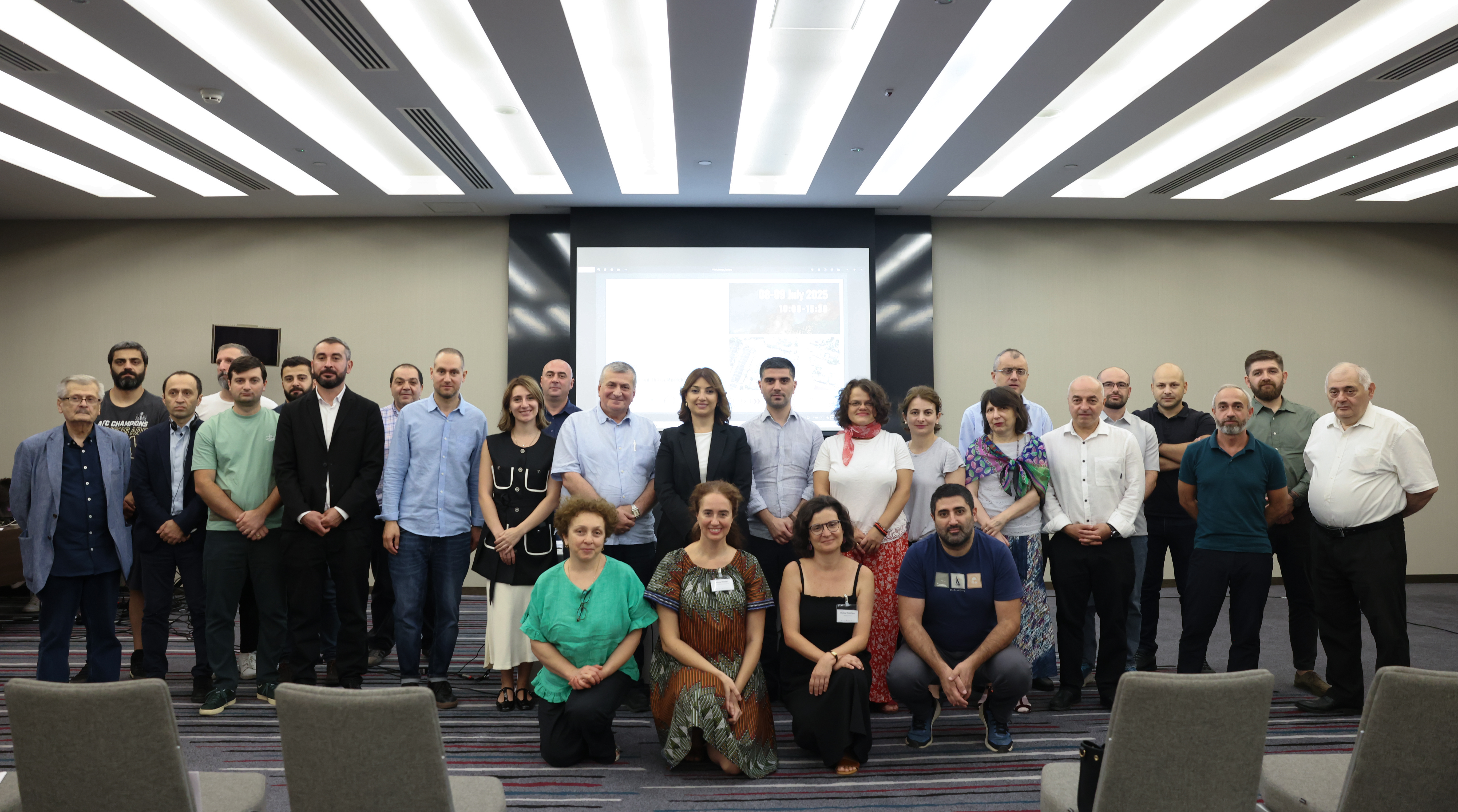
The Operational Unit “BEYOND Centre of Earth Observation Research and Satellite Remote Sensing” of the National Observatory of Athens (NOA), in collaboration with the PRAXI Network/FORTH, co-organised a two-day event in Tbilisi, Georgia, on July 8–9, 2025, with the support of the Georgian National Environmental Agency, in the framework of the European FPCUP programme (Caroline Herschel Framework Partnership Agreement on Copernicus User Uptake).
A workshop was held on July 8, followed by a hands-on session on July 9, to address the significant challenges posed by natural disasters in Georgia, while introducing the Copernicus services that support monitoring and provide critical information on floods and wildfires.

BEYOND/NOA proudly serves as Greece’s National Operations Center (GR-NOC SST) and as a key contributor to the European SST Partnership (EUSST).
From detecting and cataloguing space objects to supporting critical services like Collision Avoidance, Re-entry Analysis, and Fragmentation Monitoring, our mission is to safeguard the orbital environment and ensure the long-term sustainability of space activities.
Read more: Greece’s Role in Europen Union’s Space Surveillance and Tracking (#EUSST)